Green Route
Highway 76 Country Boulevard. The main Entertainment District corridor, lined with theaters, attractions, lodging, and food.
Getting around
Green is the Highway 76 corridor. Red, Yellow, and Blue offer alternate approaches and connections—but construction, congestion, and your exact destination decide what works today.
Route descriptions checked August 20, 2026 against Explore Branson’s current Maps & Driving Information page.
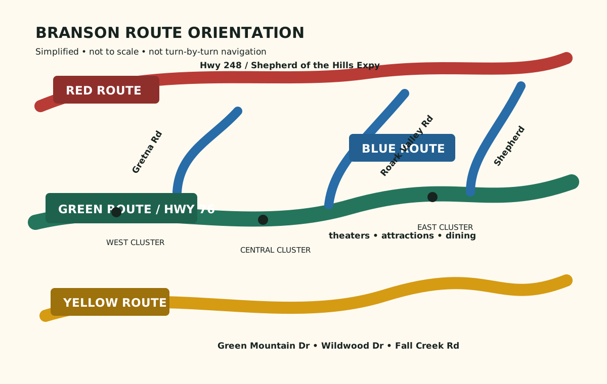
Simplified orientation diagram—not to scale and not turn-by-turn navigation.
Highway 76 Country Boulevard. The main Entertainment District corridor, lined with theaters, attractions, lodging, and food.
Northern parallel approach. Much of it follows Highway 248 and Shepherd of the Hills Expressway. It can help you approach west- and north-side destinations.
Southern parallel approach. It uses roads including Green Mountain Drive, Wildwood Drive, and Fall Creek Road.
Central alternatives and connectors. Streets between the Green and Red routes can provide another way to approach parts of Highway 76.
Alternate routes are not guaranteed shortcuts. Road work, event traffic, access restrictions, and recommended approaches change. Confirm directions shortly before departure and follow posted signs.
Open the official Branson route map ↗Imagine Highway 76—the Green Route—as the center horizontal line. The Red Route runs roughly parallel to its north along Highway 248 and Shepherd of the Hills Expressway. The Yellow Route runs roughly parallel to its south along Green Mountain Drive, Wildwood Drive, and Fall Creek Road. The Blue Route is a set of central alternatives and connectors between Green and Red. Gretna Road, Roark Valley Road, and Shepherd of the Hills Expressway connect parts of the network.